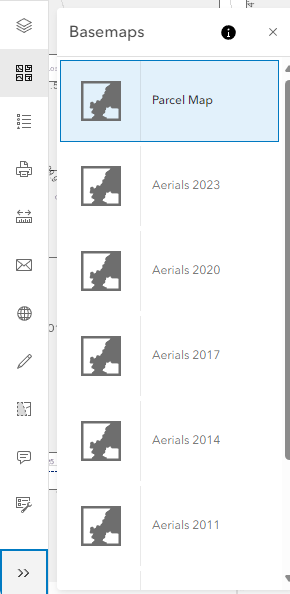
Understanding Basemaps
A basemap provides a background, or visual context for the data in a map. For example, a basemap showing streets can provide context for address data. The PCPA Interactive Map provides several different basemaps for your use. The Parcel Map is the default basemap, but you can change the basemap at any time to one of the other maps provided. The remaining basemaps have been created to show image data from various years.
Changing Basemaps
Use the Change Basemap ( ) icon on the map toolbar to select the base map with which you would like to interact. By default, the PCPA Interactive Map opens to the Parcel Map. You can switch to any available basemap by selecting it.
|
PC or Tablet |
Mobile Phone |
|
|
|

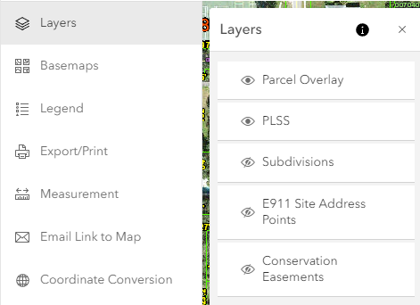
Layers
The operational layers collection is used to display geographic data layers on top of a basemap layer in a Map.
Note: To turn layers on or off click on the eye ( ) Icon.
|
Parcel Overlay |
|
This layer is displayed when one of the aerial basemaps is selected. And includes County Boundary, Major Roads, Roads, and Waterbodies. Note: Some of the layers will not always be available depending on how far you are zoomed in or out. |
|
PLSS |
|
This layer shows the Public Land Survey System which is a method of subdividing and describing land in the United States. Turn on this layer to view Section, Township, and Boundaries and Government Lots information on the map. |
|
Subdivisions |
|
Layer that identifies platted (recorded) land that has been divided from a larger area. (This is by default turned off.) |
|
E911 Site Point Addresses |
|
This layer shows the Polk County Emergency Management 911 Addressing Site Point Data. For additional information or to report errors please call 863-534-5636. (This is by default turned off.) |
|
Conservation Easements |
|
Layer showing conservation "restrictions" determined by agreement between a landowner and a land trust or government agency that permanently limits use of the land in order to protect its conservation values. (This is by default turned off.) |