Buffer Tool
A buffer option has been added to the Select Parcels Widget.
To Select parcels using the Buffering Tool, follow the instructions below:
1.Set the Buffer switch to on. 
2.Controls for entering a buffer radius and a button for creating the buffer will become visible.
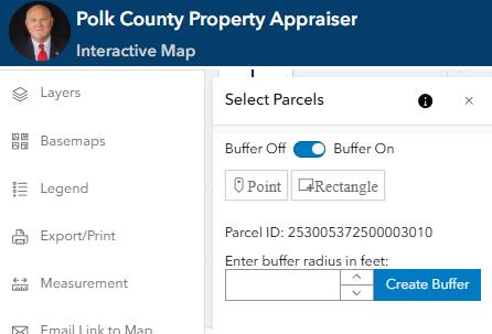
3.The current selected parcel will be used by default as the buffer graphic. Optionally you can create a new graphic utilizing the Point or Rectangle buttons. It is important to note that creating a new graphic will result in the selected parcel being cleared.
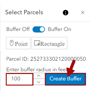
Note: If you have already selected a parcel the parcel id number will be displayed just above the "create buffer" button. If no parcel is selected the text above the "create buffer" button will indicate "Parcel ID: N/A". For further guidance on selecting a parcel, please refer to the "Search, Select, and Explore" section of this help file.
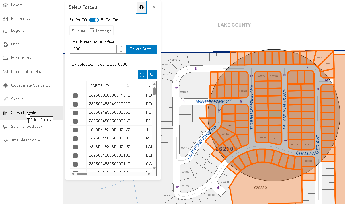
4.Enter the buffer radius in feet (max allowed is 5,280), then click on Create Buffer. Please note, changing the selected parcel after creating the buffer will clear the buffer results.