Select Parcels
Select Parcel Widget
The Select Parcel widget allows you to select and highlight parcels on the map and maintains a table of selected parcels. You can zoom back to a previously selected parcel by clicking on a row in the table and you can export the selected parcels to a CSV file.
Please note that owner names displayed or exported from this website may not be current.
Deeds and other documents that impact property ownership are officially recorded in the records of the Polk County Clerk of Court's Office. Once recorded, our office receives electronic copies of these documents. However, before these ownership transfers are available on our websites, they must undergo several processes, including individual document review to determine intent, mapping, qualification coding, and entry into our records.
Typically, the Property Appraiser's Deed Department takes a minimum of four to six weeks to process these transfers after recording. However, due to an unusually high volume of recorded documents, processing times have been delayed. The complexity of the transfers received can also affect this timeframe. For instance, if your document results in the division of a property, it must be sent to the Mapping Department for further review and processing.
Follow the steps below to perform a search.
1.Click or tap on the Select Parcel tool in the Map tool bar.
NOTE: For Instruction on the Select Parcel buffering tool click here: Buffer Tool
2.Select either the Point or Rectangle tool.
The following is only available on a PC or Tablet:
▪When the Point tool is active (the button will be highlighted blue) the mouse will change to a cross hair with a circle in the middle ( ) and you can use the mouse to click on individual parcels to select them and add them to the parcel list.
▪When the Rectangle tool is active (the button will be highlighted blue) the mouse will change to a cross hair ( ) and you can draw rectangles on the map to select all parcels within the rectangle to the parcel list.
NOTE: Popups are disabled while the Point or Rectangle tools are active. The tools will remain active even if you close the select parcel widget. To deactivate the tools re-click or re-tap on the selected tool (the button will no longer be highlighted blue only on a PC or tablet. The button will continue to be highlighted blue on a cell phone until you tap somewhere else).
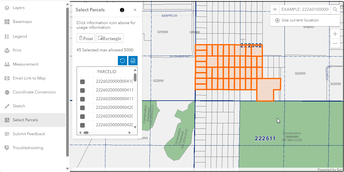
3.The parcels that have been selected are returned and listed within a table in the select parcel widget and the number of parcels selected is shown. You can zoom back to a previously selected parcel by clicking on a row in the table.
4.You can clear the parcel list by selecting the clear section button ( ).
).
5.Or You can then export the parcels to a CSV (comma-separated values) file. Click or tap the download your CSV ( ) button to access the file. The file contains the parcel number, first owner name and mailing address, and the Department of Revenue (DOR) Use Code and description of the selected parcels.
NOTE: A maximum of 5000 parcels can be selected at a time. The amount of parcels you have selected are shown within the Select Parcel widget.
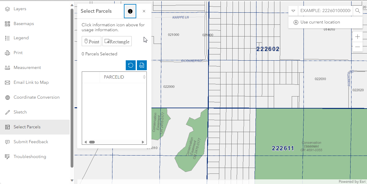
BEFORE SELECTION
|
|
AFTER SELECTION
|