Using the Measurement
The measurement tool allows you to measure distance and area by drawing a point, line or polygon on the map and specifying the unit of measure. There are two measure tools available. The Area and Distance measure tools can be changed to the following units of measure: acres, square miles, square kilometers, hectares, square yards, square feet, and square meters. Follow the steps below to use the measure tools.
|
Measure Distance
|
Measure Area
|


Measuring distance and areas
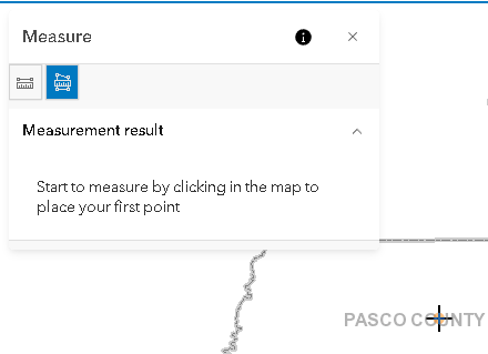
1.Select the measurement ( ) tool on the map toolbar.
2.Select the Measure Area button to measure a polygon or the measure distance button to measure a line.
3.Click or tap the map at the location where you want to start measuring.
4.Move the pointer to the next point that you want to measure and click or tap. If you would like to measure along the curve of a line, click or tap along the line to add points.
5.Use the enter key on the keyboard, Double-click, or double tap when you want to end the line or polygon and complete the measurement.
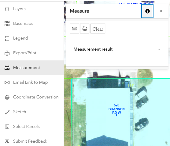
6.Use the drop down menu to select the desired unit of measure.
7.The measurement will appear in the Measurement Result area.
8.To clear the result click or tap the clear button or click onto another widget.
9.To start a new measurement click the New Measurement Button.
NOTE: Popups are disabled while measurement tool is active. The measurement button will be highlighted when the tool is active, and the mouse cursor will change to a cross hair( ).
).